

How to plan an offline manhole-cover hunt
Download the supported map area while you have reliable Wi-Fi, open the priority cover details once, save essential official links or addresses separately, and keep a short fallback route that does not depend on live data.
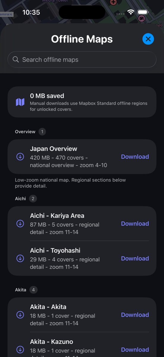
Offline does not mean every service is cached
A downloaded map area helps you keep geographic context when reception is weak. It does not automatically archive every external official website, current transit alert, weather update, or third-party navigation result.
Before leaving, decide which facts are essential without a connection: the start and end stations, cover addresses, safe public access points, and the route back.
A reliable pre-trip checklist
- Connect to power and stable Wi-Fi.
- Open Offline Maps and download the supported area that contains the planned route.
- Confirm the download completes and inspect the area before disconnecting.
- Open priority cover details and verify their official source pages.
- Save essential addresses outside the app and carry enough battery for camera and mapping use.
Test the plan before relying on it
After downloading, briefly place the phone in airplane mode and confirm that the saved area and the core app screen still appear as expected. Turn airplane mode off again before departure so emergency, transit, and communication services remain available.
If the offline area is missing or stale, do not assume it will repair itself on the street. Re-download while you still have a dependable connection.
Keep the route resilient
- Prefer a loop that starts and ends near known transit.
- Keep one high-priority stop and several optional stops.
- Allow time for construction, crowds, rain, or a missed entrance.
- Never continue into an unsafe or restricted area because the offline pin appears nearby.
- Use live official information whenever safety or access depends on it.
Official and primary sources
Open the current source before travel. These links support the guide; they do not imply affiliation or permission to reproduce official images.
Questions
Will official source pages work offline?
Not necessarily. Save essential details before the trip and reconnect when you need current information.
Should I download all of Japan?
No. Download only supported areas you expect to use so storage and updates remain manageable.
Can offline maps replace safety checks?
No. Street conditions, closures, signs, weather, and instructions from local authorities always take priority.
Plan the route in Manhole Quest
Use the map, official source links, supported offline areas, and on-site scanning to turn the guide into a practical walk.
 Browse all guides